Écosse 2014
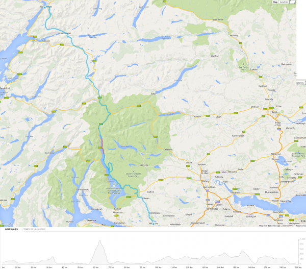
Le West Highland Way en quelques chiffres :
- Distance 188.39 km
- Altitude min 0 m
- Altitude max 980 m
- Total montée 6121 m
- Total descente 6117 m
Les réjouissances jour après jour
- 2 juin 2014 – Milngavie – Hauteurs de Balmaha (29.20 km)
- 3 juin 2014 – Hauteurs de Balmaha – Nord de Rowardennan (23.77 km)
- 4 juin 2014 – Ascension du Ben Lomond – Botty de Rowchoish (23.80 km)
- 5 juin 2014 – Botty de Rowchoish – Beinglas Farm (Inverarnan) (19.02 km)
- 6 juin 2014 – Beinglas Farm (Inverarnan) – Bridge Of Orchy (30.87 km)
- 7 juin 2014 – Bridge Of Orchy – Kingshouse Hotel (20.39 km)
- 8 juin 2014 – Kingshouse Hotel – Kinlochmore – Allt Coire a Bhutna (20.24 km)
- 9 juin 2014 – Allt Coire a Bhutna – Fort Williams (21.10 km)
Trace GPS (Format .gpx) de Milngavie à Fort Williams + Ascension du Ben Lomond

On se refait quand un truc pareil ?… 😉